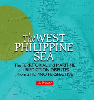
It’s available online: http://www.babaylan.dk/wp/wp-content/uploads/2013/07/UP_Primer-on-the-West-Philippine-Sea_April-2013_0.pdf
Prepared under the direction of experts on the subject (Dean Eduardo T. Gonzalez of the Asian Center; Aileen S. P. Baviera, professor, Asian Center; and Jay Batongbacal, director, Institute for Maritime Affairs and Law of the Sea of the UP College of Law), the timing of the primer is perfect as tension in the area continues to simmer.
The authors have succeeded in simplying the complicated topic. It covers history of the conflict and recent events. Bajo de Masinloc, also known as Panatag shoal and by its international name Scarborough Shoal (Chinese name is Huangyan island) which has been the area of conflict since the standoff April last year involving Chinese and the Philippine ships, is well covered.
Understandably, not extensively discussed is the Ayungin Shoal issue which started last month with China complaining about the not removal by the Philippine Navy of the grounded BRP Sierra Madre from the reef some 21 nautical miles away from the Chinese occupied Mischief Reef.
Although as the title states, the primer is from a “Filipino perspective”, the presentation is objective. It enlightens, it does not agitate.
The General Introduction, for example, differentiates West Philippine Sea from South China Sea. This is useful because many journalists interchange the two terms which is wrong.
The Primer says “The West Philippine Sea refers to the part of the South China Sea that is closest, and ofvital interest, to the Philippines…. It includes the Luzon Sea, as well as the waters around, within and adjacent to the Kalayaan Island Group (KIG), and Bajo de Masinloc also known as Scarborough Shoal.”
The West Philippine Sea is part of the South China Sea, which the Primer says is “a much broader expanse of water, often described as a semi-enclosed sea, bounded by China/Taiwan in the north, by the Philippines in the east, and by Vietnam, Malaysia, Singapore, Indonesia, and Brunei in the west and south. The Gulf of Tonkin and Gulf of Thailand also abut the South China Sea. “
“Scattered over the South China Sea are various geographic features, the most prominent of which are known internationally as the Spratlys, the Paracels, Macclesfield Bank and Pratas Island. There are overlapping claims by various countries to these features and to the waters and resources surrounding them, including parts of the West Philippine Sea,” the primer says.
How about Kalayaan Island Group which journalists also often interchangeably use to refer to Spratly islands?
The Primer says “The Kalayaan Island Group (is a group of over fifty features and their surrounding waters that belong to the Philippines, located in what is internationally known as the Spratly Islands. The KIG is not the same as the Spratlys, however, as there are features in the Spratlys that are not part of the KIG.”
The authors said the primer is s intended to assist students, researchers, media practitioners, non-specialist members of the civil service, as well as the general public, in deepening their understanding of the many different issues of the West Philippine Sea disputes.
Add “Malacanang officials” to the list who need to read the primer.
I’ll post this link here again. For records keeping.
In summary, this is what the US Embassy in Beijing thinks of the Nine-dash line claim of China: THE “COW’S TONGUE” IS NOTHING BUT BULL. THEY CAN’T PROVE IT.
This is contained in one of the Wikileaks documents.
http://wikileaks.org/cable/2008/09/08BEIJING3499.html
Na-extra ka pala sa 9-dash line, Tongue.
Excerpts:
This is the main reason China has been very vocal about pushing bilateral negotiations instead of a multiparty approach or a code of conduct in the region. China is aware of the perception and bias of the powerful western nations and are banking merely on goodwill-masked bribery of the claimant countries’ leaders like they did with the super corrupt Gloria Arroyo. Until this day, they have zero evidence nor valid argument that can support their claim of, in their own words, “undeniable sovereignty”.
This claim is easily demolished by Vietnam with a Vietnamese researcher’s 1904 map printed by China itself which depicts Hainan island as the southernmost territory of China. Read here: http://www.saigon-gpdaily.com.vn/national/2012/7/102223/
Of course we are aware of the existence of Spanish era maps that clearly identifies such island groups like Bajo de Masinloc, Spratlys, etc as part of the Philippines and that such evidence precedes by centuries any document or map that either Vietnam or China can provide.