(Conclusion)
The issue of whether Itu Aba (also known by its Chinese name “Taiping” and Philippine name “Ligaw”) is an island or a rock has become a battle of experts.
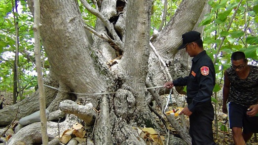
In the hearing at The Hague last Nov 30 on the Philippine suit against China’s nine-dash-line and constructions in submerged maritime features in the Spratlys, the American lawyer of the Philippines, Paul Reichler, presented a 1994 study which was the result of a botanical expedition funded by the Republic of China (Taiwan)’s Council of Agriculture, Executive Yuan.
Reichler quoted from the study which stated: “The underground water is salty and unusable for drinking.”
Reichler said “There is no potable water. Drinkable water by itself may not be a sufficient condition to sustain human habitation, but it is certainly a necessary one. Itu Aba does not satisfy it.”
The American lawyer also said “The island is an atoll consisting of a tropical 10 reef covered with sandy coral and shell.” That is: no topsoil. … Without tillable soil, there is no agricultural production sufficient to sustain human habitation.”
Reichler concluded: “This (Itu Aba) is a rock.”
Rocks, according to the United Nations Convention on the Law of the Sea or UNCLOS, “which cannot sustain human habitation or economic life of their own shall have no exclusive economic zone or continental shelf.”
In a lecture on the South China Sea at Ateneo de Manila last year, Senior Associate Justice Antonio T. Carpio said if the U.N. Tribunal favors the Philippine government’s assertion that Itu Aba is not capable of human habitation or economic life of its own, “the tribunal will then declare that Palawan has a full 200 nautical mile Economic Exclusive Zone facing the West Philippine Sea.”
The implication of this is astounding. “This means,” Carpio added, “that all submerged features within this EEZ, like the Reed Bank and Malampaya, are subject to exclusive economic exploitation by the Philippines in terms of fisheries, oil and gas, and mineral resources.”
Furthermore, Carpio said, “If the Philippines has a full 200 NM EEZ in Palawan facing the West Philippine Sea, only the Philippines can create artificial islands on submerged areas or erect structures on LTEs (Low Tide Elevation) within its 200 NM EEZ. Artificial structures or reclamations made by other countries, namely by China and Vietnam, are illegal.”
What about if the U.N. Tribunal ruled Itu Aba is an island, capable of human habitation or economic life of its own?
Carpio said, then the case as far as Itu Aba and Palawan are concerned becomes an issue of overlapping EEZs (The distance between Palawan and Itu Aba is 225 NM), outside of the tribunal’s jurisdiction in view of China’s reservation excluding boundary delimitation issues from compulsory arbitration.
The Philippine legal panel presented in the The Hague hearing Australian Professor Clive Schofield, an expert in maritime boundary delimitation and marine jurisdictional issues and has written a number of articles on Itu Aba.
Schofield told the tribunal: “At first glance, Itu Aba and one or two of the other partially vegetated and occupied features may appear as though they might be able to escape the net of Article 121(3). However, on closer examination, they cannot, because they lack the key requirement for full island status, namely the presence of civilian populations, the availability of potable water, and the existence of agricultural or economic activity. Not coincidentally, they are also rather small. “
Article 121 (3) is UNCLOS definition of rocks.
Schofield further said, “That is why we reached the conclusion, from a scientific and geographic perspective, and having regard for the conditions set out in Article 121(3), that Itu Aba is most appropriately treated as an Article 121(3) “rock”.
Taiwan, which occupies Itu Aba, and like China also claims almost the whole of the South China Sea (some of the features in the area are also being claimed by the Philippines, Vietnam, Malaysia and Brunei) insists Itu Aba is an island.
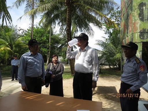
Taiwan is not a participant in the The Hague hearing but recently, Yann-huei Song, a research fellow in the Institute of European and American Studies, Academia Sinica in Taipei, wrote in Asia Maritime Transparency Initiative online site attesting that water in Itu Aba is potable.
He said he has been to Itu Aba four times. He belittled the testimony of Schofield, who, he said, has never been to Itu Aba.
Yan-Huei said “But I suspect he (Schofield) would change his opinion if he were invited to visit the island and, like me, had the chance to drink fresh water from the skimming well and eat a lunch of cooked vegetables and fruits picked from the island’s garden.”
The Philippine legal team latched on to the term “skimming well.”
Reichler said according to the United States Department of Agriculture, the skimming well is a technique employed with an intention to extract relatively freshwater from the upper zone of the fresh-saline aquifer. “
Reichler further said: “Certainly the Taiwanese troops on Itu Aba could not survive from whatever it is that this facility produces. That is why Taiwan built two modern desalination facilities in 1993. And that constitutes further proof that there is no naturally occurring water on the feature that is suitable for drinking, much less sustaining human habitation.”
Yan-Huei’s article said:”During my four visits to Itu Aba, I have seen indigenous plants that are more than 32 feet (10 meters) tall. There is a nearly 4,000-foot (1,200-meter) runway, two piers, a guest-house building, a postal office, a small hospital, a big agricultural garden, livestock, and a temple. In addition to drinkable water that is available at the four skimming wells, indigenous soil on the island has also long been used for growing fruits, including banana, coconut, and papaya, and vegetables such as wild bitter squash, loofah, and cabbage. It should also be noted that internet and cell phone access are available on Itu Aba, along with solar power for electricity.”
All those amenities, of course, do not answer the basic question: Is Itu Aba an island or a rock?
We await the U.N. Arbitral Tribunal’s word on that.
May tubig din sa PagAsa. Tabsing lang nga gaya ng sa kanila.
Even if the tribunal finds that Itu Aba is an island, ratios and proportion would apply. Palawan will have a bigger share of the EEZ since Palawans coastline is 650 times longer than Itu Aba. Palawan will still get a 200 mile EEZ – Reed bank included.
Abangan, indeed.
Meantime, China is busy refreshing its territorial maps to include the area as part of their sovereign territory with a flimsy reason — ” look!.. we even have an ancient name attached to the place, that’s why it’s ours! ”
Its a distinct possibility that could happen and if the government allow such travesty and succumb to it, the Philippines might as well volunteer itself as a China province since its fairly known that Chinese has also an ancient name for our country.