Skip to content

Tag: USS Guardian

USS Guardian probe report evades key issues, raises more question


By Rex Robles, VERA Files

USS Guardian in Okinawa, Japan. Jan. 2013
Last week, the US Navy released the result of its investigation on the Jan. 17, 2013 grounding of USS Guardian in Tubbataha Reef in the Sulu Sea, pinning the blame on “lack of leadership” but praising the “heroic efforts of the crew to save their ship.”

One reason why the report seems superficial and incomplete is that it failed to attach true copies of essential navigational documents.

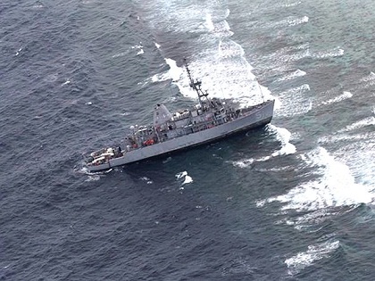
As a rule, whenever a Navy ship leaves port for any destination, the path or course it is to take to reach its destination is set down beforehand on a maritime map, commonly referred to as a chart. This is required for those navigating over water and all Navy vessels, except small boats on short trips along a coastline or a river, must perform this basic task.

The charted course is an official record of a ship’s movement and, together with the Quartermaster’s logbook that records the actual position, heading and speed of the ship at any time, will form an important part of any investigation involving that ship and its crew.

Trawling Tubbataha’s treasures

USS Guardian in Tubbataha.

By Rex Robles,VERA Files

It was 1974 and I was taking up an advanced course in Mechanical Engineering at the US Navy Postgraduate School in Monterey, California. For our final exam in Oceanography, our professor simply called the twelve of us to his office one by one and asked us a few questions. I noticed a certain level of interest in the Philippines that I did not expect.

For instance, he showed me a satellite photograph of Manila Bay and asked me what I thought about a plan to build a highway along the Manila-Cavite coastline. I mumbled some comment on how the ecology in the area would be affected.

Then he showed me photographs of the entire Sulu Sea with what looked like ridgelines in the water running roughly parallel to Palawan. I was intrigued. My professor, who is based in New Zealand, told me they were a dozen or so swells that go northwest at certain times. At other times, they go the opposite way.